 Fraunhofer Institute for Wind Energy Systems
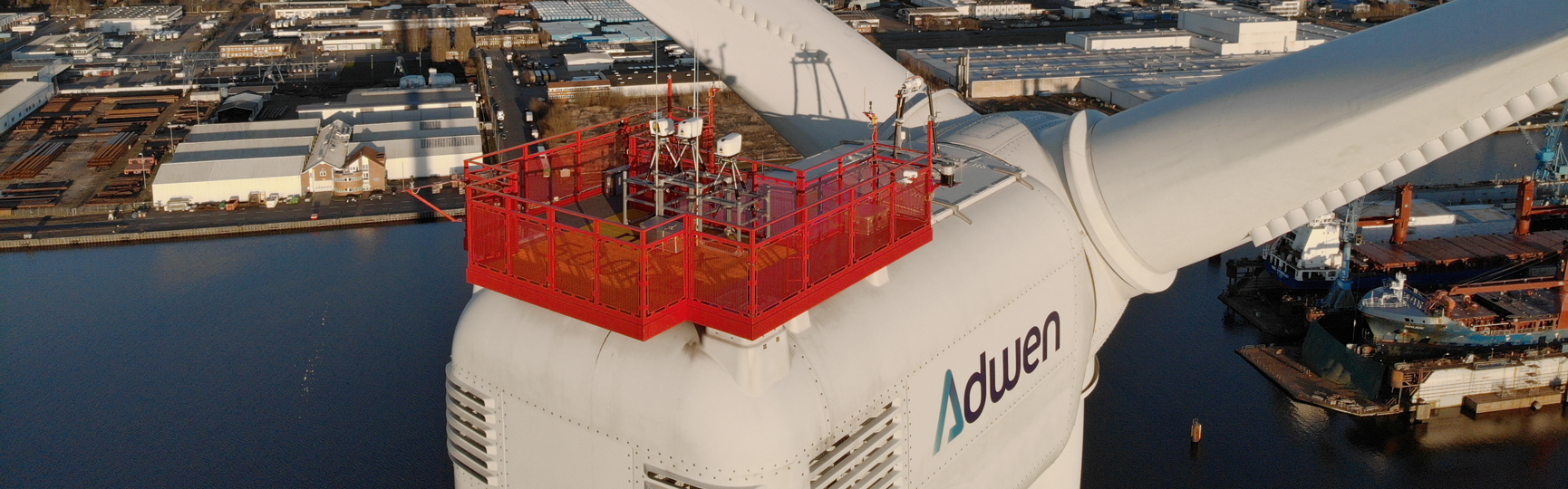
Fraunhofer IWES uses various methods to measure wind fields in order to be able to evaluate them optimally.
Wind measurement: Utilization of remote sensing for the optimal assessment of wind resources
Use of remote sensing methods and technologies
Development of innovative measuring concepts
Analysis and evaluation of wind field and wind resource data
Fraunhofer IWES employs a wide range of different technologies for tasks from the surveying of small-scale, turbulent wind fields up to the documentation of wind resources at a site over a number of years. Remote sensing methods such as lidar (light detection and ranging) are used as standard. When developing innovative measuring concepts, IWES takes the range and scales to be recorded as well as the use of cost-efficient measuring instruments into consideration. IWES also employs a range of data processing and wind field reconstruction methods for the collection of final wind field and wind resource data. A further focus is the recording of additional atmospheric parameters based on the wind measurements and supplementary measurements for optimal wind resource and site assessment.
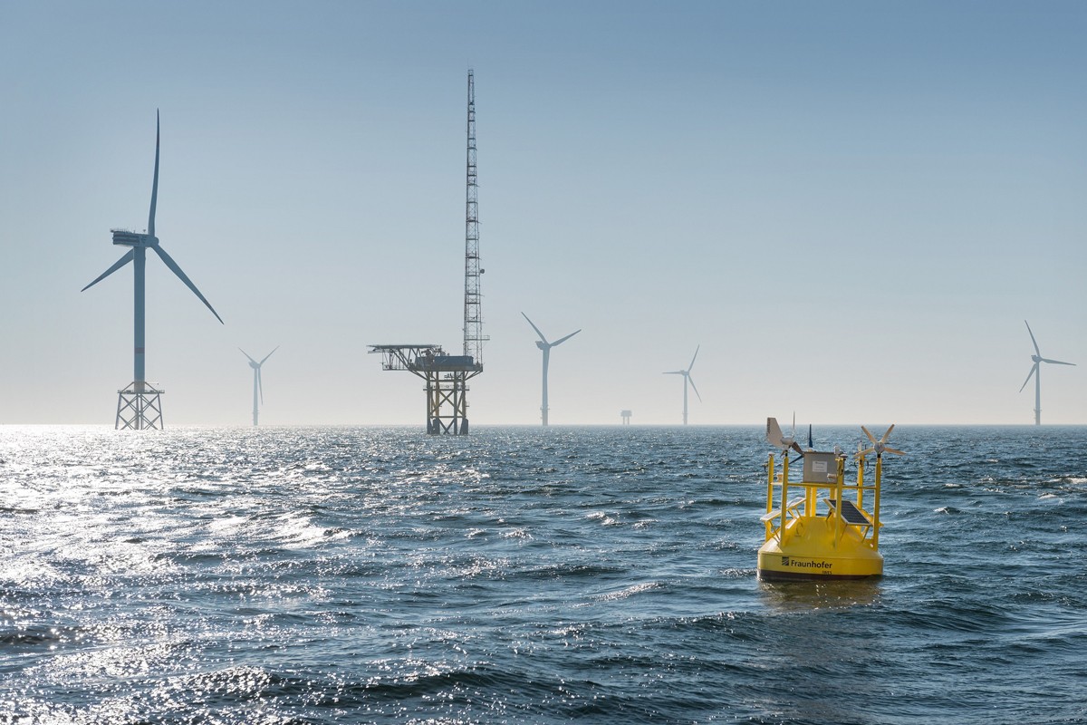
Remote sensing methods like lidar are now employed as standard in the wind industry and wind energy research. The areas of application range from the surveying of small-scale, turbulent wind fields to the recording of the wind resources at a site over a number of years. Fraunhofer IWES employs corresponding technologies for both onshore and offshore measuring campaigns and is continuously further developing the associated applications in cooperation with industry. The wind measuring devices for this purpose are installed on the ground, on wind turbine nacelles, and offshore on buoys and vessels. The important thing is that the technology is selected and employed in such a way as to create an optimal added value for industry and applied research. This requires not only a detailed understanding of the technology but also comprehensive experience in the respective area of application.
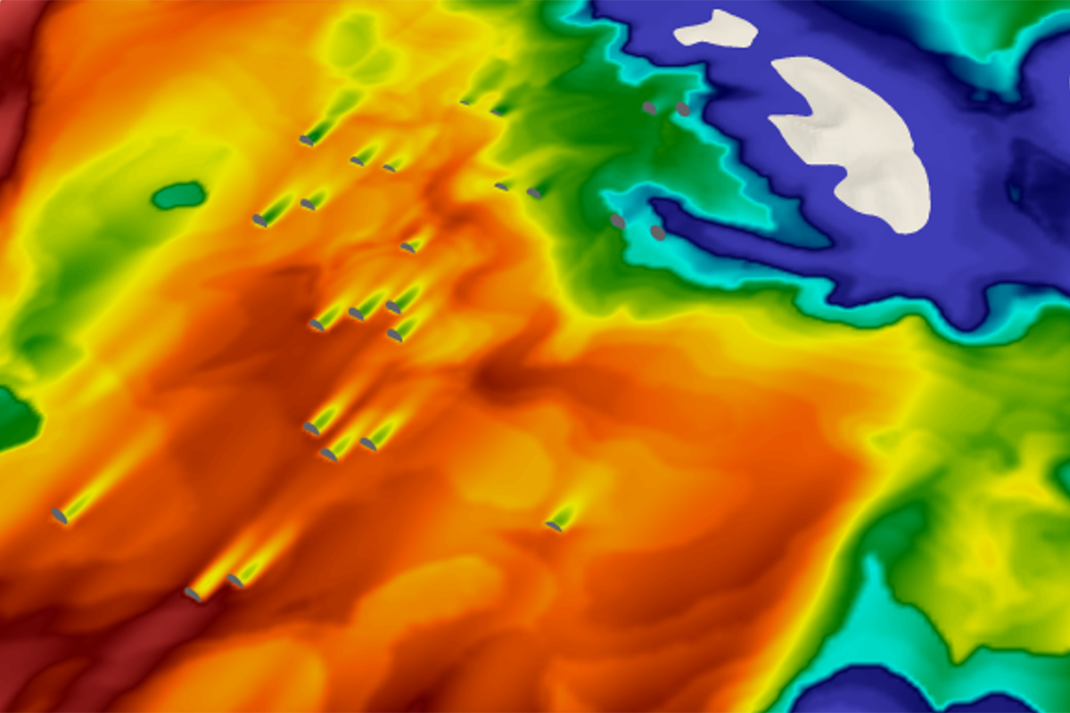
Remote sensing technologies are characterized by their great flexibility as far as both their range and the scales to be recorded are concerned. IWES takes both into consideration when developing innovative measuring concepts. IWES employs numerical modeling methods so as to be able to determine measuring points optimally. This is done by simulating the wind flow and inserting the wind measurement while defining the specific measuring principle. This approach makes it possible to determine the type of wind phenomena and the quality of the metrological detectability in advance.
The measurement precision and scale resolution are investigated in extensive comparative measurements. Furthermore, IWES uses mathematical modeling methods to estimate measurement uncertainties and configure measuring setups in such a way as to be able to minimize the final measuring data uncertainties. The targeted investigation of measuring concepts also helps to select the right types of measuring instruments in advance, thus enabling a cost-efficient measuring campaign.
IWES employs a range of data processing and wind field reconstruction methods to arrive at the final wind field and wind resource data. The wind measurement data obtained in this manner are further extrapolated and interpolated to different spatial and temporal scales at IWES. Among other things, machine learning methods are also applied. IWES correlates the wind measurements with (freely available) reanalysis data in order to verify the measurement data optimally during the actual measuring, to recognize deviations, and to be able to identify the added value of site-specific measurements.
Depending on the application, the measurement data are then prepared for a range of further uses. For a wind potential analysis, this includes the closing of data gaps utilizing a variety of numerical methods. In the scope of a site assessment, site parameters are extracted or calculated at IWES which can be used for example in synthetic wind field simulation.

In addition to researching and developing new solutions for wind measurement and characterization, IWES is also active in the standardization of existing solutions for industry. This includes the pre-normative standardization of wind lidar applications in the scope of the international IEA Wind Task 52, which IWES has led as Operating Agent since 2022. Furthermore, IWES is also a member of the IEC expert committees for the development of (normative) technical specifications for the use of floating lidar (IEC 61400-50-4) and scanning lidar systems (IEC 61400-50-4).
The large-scale deployment of remote sensing technologies for wind measurement in the wind industry will only be possible once the measurement procedures have been sufficiently standardized and, in particular, once the methods for quantification of the associated measurement uncertainties have been coordinated in detail. In the scope of its applied research work, IWES sets great store by this commitment.
In addition, gaps in the guidelines indicate unresolved research and development issues that IWES is prioritizing.
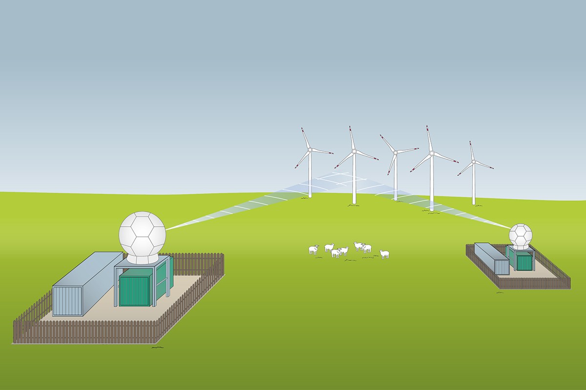
On the basis of many years of experience in the application of remote sensing methods and, in particular, lidar technology in the field of wind energy research, IWES is also involved in the testing of new technologies for measuring wind on the scales relevant for wind energy utilization. The Wind farm RADAR project is investigating how radar technology with a significantly greater range than laser-based lidar can be employed to measure wind fields in and around wind farms. Aside from the range, the aim is to be able to employ new technology like lidar with the result that the existing guidelines and standards can, ideally, be expanded.
A further research focus is on recording additional atmospheric parameters based on the wind measurements and/or supplementary measurement variables, with the aim of being able to characterize wind fields comprehensively at existing and future wind farm sites and, ultimately, to enable optimal wind resource and site assessment.